

Mt. Raung Trekking Details
Mt. Raung Trekking Details: A Guide to the Toughest Hike in Java
Mount Raung, part of the Ijen mountain range, is famous for being one of the most challenging treks in Java. Located in East Java and spanning four regencies—Bondowoso, Jember, Situbondo, and Banyuwangi—this active volcano offers a unique and demanding adventure. Its trails are known for their lack of water sources and, on some routes, require technical climbing skills.
At 3,332 meters above sea level, Mt. Raung has two popular trekking routes. The first is via Kalibaru, Jember, which leads to the highest peak, known as “Puncak Sejati” (The True Peak), and requires technical rope climbing. The second, and the one we will focus on, is the Sumber Wringin route from Bondowoso. This route takes you to the stunning “Tusuk Gigi Peak” (Toothpick Peak), where you can marvel at the massive caldera without needing technical climbing skills. While this path avoids ropes, it is still incredibly challenging, with narrow trails along deep cliffs near the summit.
This guide provides a detailed look into the Mt. Raung trekking details via the Sumber Wringin route, which typically takes 11-12 hours to ascend.
Mt. Raung Trekking Itinerary: Up the Mountain
Basecamp to Shelter 1 (Pondok Motor)
- Duration: 45 minutes by car or 4 hours on foot.
- Details: The 7 km stretch from the base camp to Pondok Motor can be easily covered by vehicle, a recommended option to save energy. The path passes through local farmlands and plantations.
Shelter 2 (Pondok Motor) to Shelter 3 (Pondok Sumur)

- Duration: 3 hours.
- Details: This segment continues through farmlands with many branching paths, so it’s essential to stay on the correct trail.
Shelter 3 (Pondok Sumur) to Shelter 4 (Pondok Demit)

- Duration: 2 hours and 30 minutes.
- Details: From here, the trek becomes a steady uphill climb through a lush tropical forest. Pondok Demit is a wide, flat area inside the forest, but be aware there are no water sources here.
Shelter 4 (Pondok Demit) to Shelter 5 (Pondok Mayit)
- Duration: 2 hours.
- Details: The landscape changes as the path exits the tropical forest and enters a savanna with pine trees. This is an ideal spot to set up camp for the night before a summit attack. Remember, there are no water sources at this shelter either.
Shelter 5 (Pondok Mayit) to the Peak of Mt. Raung
- Duration: 1-2 hours.
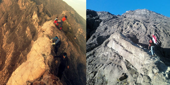
- Details: The final push takes you through a vast savanna and then into an area with no vegetation. Here, you’ll pass a memorial for Deden Hidayat, a trekker who tragically passed away on the mountain. The path becomes steep and rocky with very little flat ground. Extreme caution is required as you navigate the narrow cliffside trail to the summit.
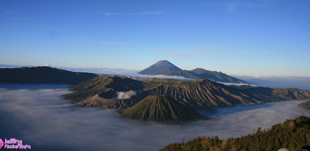
From the peak, you’ll be rewarded with a breathtaking view of Mt. Raung’s massive caldera. You might even hear the sounds of its active inner crater. Look up, and you’ll see the higher “Puncak Sejati,” a constant reminder of the even more challenging route available for technical climbers.
Trekking Down
The descent from Mt. Raung takes approximately 6-7 hours. With normal breaks, you should arrive back at the base camp in the afternoon, completing your memorable trekking adventure.
Trekking Summary
- Total Ascent: 11-12 hours.
- Total Descent: 6-7 hours.
- Overnight Camp: Recommended at Shelter 5 (Pondok Mayit).
- Key Challenge: No water sources along the route.
Essential Equipment
Before you embark on this challenging trek, make sure you have the following:
- Health and Stamina: This is a demanding trek, so good physical condition is a must.
- Medical Certificate: A health certificate from a doctor is required.
- Footwear: Wear proper trekking shoes with good grip.
- Clothing: Bring a long-sleeved T-shirt and a warm jacket.
- Sleeping Gear: A sleeping bag and mattress are essential for your overnight stay.
- Lighting: A headlamp is crucial for night hiking.
Read More
- Menjangan Island Access Comparison (2026): Bali vs Banyuwangi — Which Is Better?
- 8 Best Activities Bawean for a 1-Day Shore Excursion
- 8 Fascinating Facts About Bawean Island: The Java Sea’s Hidden Eden
- Exploring Bawean Island: The Hidden Gem of the Java Sea You Must Visit
- Menjangan Island Snorkeling Price Guide (2026): What You Actually Pay
Fishing (22 Trips)
Hiking (35 Trips)
Jungle Safari (28 Trips)

Rafting (9 Trips)
Peak Climbing (2 Trips)
